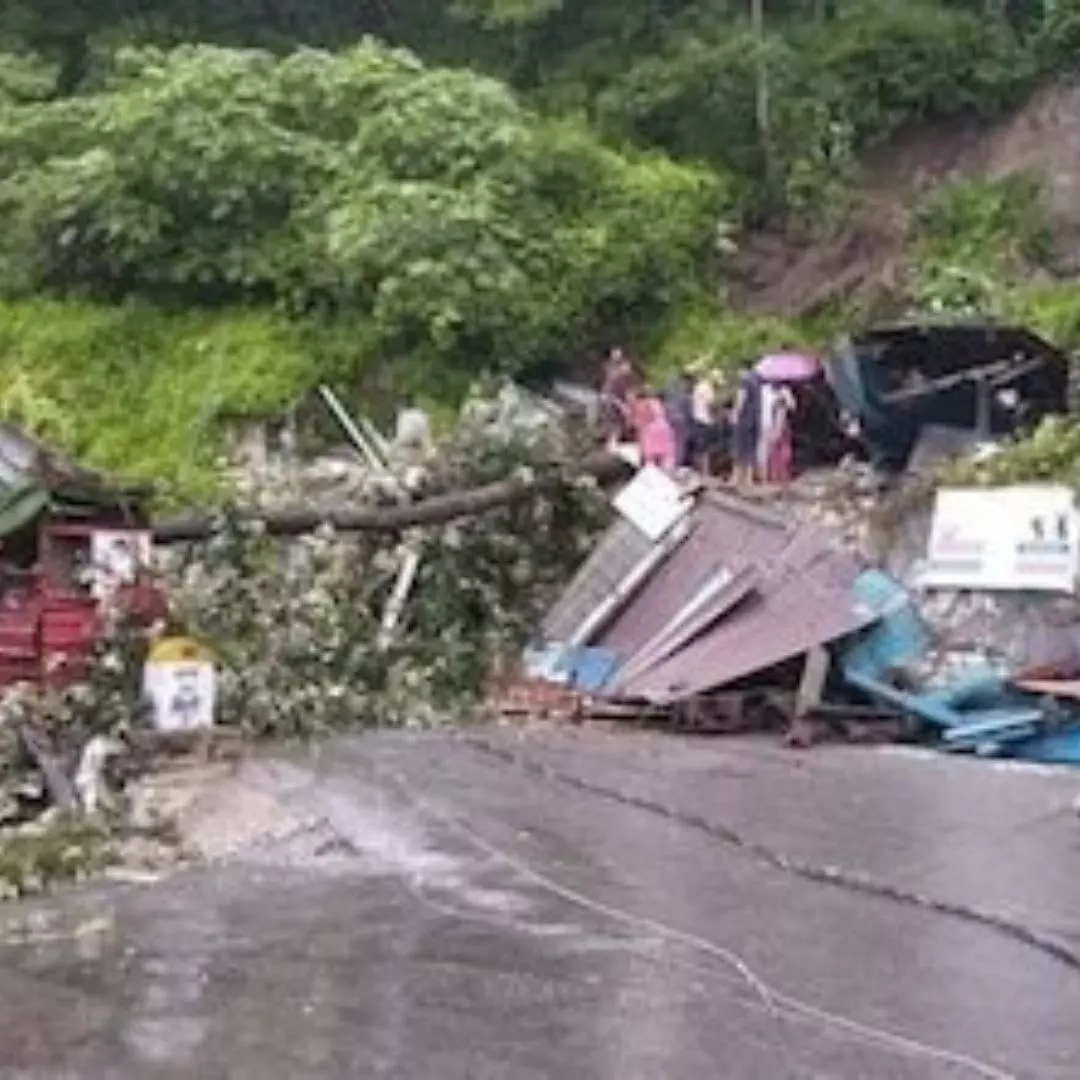

Heavy rains pounded various parts of Uttarakhand, causing landslides that blocked several roads on Sunday, July 16th.The situation was exacerbated as the Ganga river crossed the danger mark in Devprayag and reached the warning level in Haridwar due to the release of a large volume of water from the dam on the Alaknanda river.
Officials reported that the water level of the Ganga river reached 463.20 meters, resulting in water accumulation at Sangam Ghat, Ramkund, Dhaneshwar Ghat, and Fuladi Ghat. The release of 2,000-3,000 cusecs of water from the dam of the GVK hydroelectric project on the Alaknanda river caused a significant surge in the water level of the Ganga.
Brijesh Bhatt, the Tehri District Disaster Management officer, urged people to stay away from the riverbanks and issued frequent warnings. The water level in the Muni ki Reti area of Tehri near Rishikesh rose to 339.60 meters, surpassing the warning level of 339.50 meters by 0.10 meter.
In Haridwar, the Ganga river exceeded the warning level of 293 meters and reached 293.15 meters on Sunday evening. Authorities issued alerts for low-lying areas due to the rising water level. To prevent potential damages caused by the high-speed water flow, the State Disaster Operation Centre instructed Haridwar District Magistrate Dheeraj Singh to urgently repair Gate No. 10 of the Bhimgoda barrage
The continuous rainfall in recent days has led to a flood-like situation in 71 villages across Laksar, Khanpur, Roorkee, Bhagwanpur, and Haridwar tehsils. Rescue and relief operations are being conducted with the assistance of the National Disaster Response Force (NDRF), State Disaster Response Force (SDRF), army, and state police.
In Chamoli district’s Joshimath, the abutment of a bridge on the Joshimath-Malari road was damaged by debris and excess water flowing into the Girthi Ganga river. This particular bridge was used exclusively by the Army and the Indo-Tibetan Border Police.
The Dehradun Meteorological Centre has issued an ‘orange’ alert for heavy rain in all 13 districts of Uttarakhand on Monday, July 17. The ‘orange’ alert signifies extremely adverse weather conditions that may cause disruptions in transportation, including road closures and power supply interruptions.Furthermore, the water level of the Kali river in Dharchula area, Pithoragarh, is flowing above the warning level of 889 meters.
The floods have affected 3,756 families in 71 villages of Roorkee, Bhagwanpur, Laksar, and Haridwar tehsils. Out of these families, 81 have been relocated to relief camps. Sadly, five people have lost their lives in the affected areas. Seven houses have been completely destroyed, while 201 have suffered partial damage. In addition, 17 roads and nine bridges have been damaged due to heavy rains in Haridwar, as per a report in The Print.
Kapkot received the highest rainfall in the state, measuring 70 mm, within the past 24 hours, according to the State Emergency Operation Centre. Other areas that experienced significant rainfall include Mussoorie (61 mm), Karnprayag (57 mm), Chamoli (54.4 mm), Nagthat (53 mm), Mohkampur (48 mm), Vikasnagar (41 mm), and Uttarkashi (39 mm).
The officials have reported that 2,000-3,000 cusecs of water was released from the Srinagar Hydro Electric Project dam in Pauri district due to the Alaknanda river flowing above the warning level.
The State Emergency Operation Centre has advised the district magistrates of Tehri, Pauri, Dehradun, and Haridwar to take necessary precautions to mitigate the situation.
Flood Situation In Delhi
The residents of Delhi can expect some relief from the recent floods and waterlogging as the water level of the Yamuna River has started receding. At 11 PM, the water level at the Old Railway Bridge was recorded at 205.50 meters, indicating a decrease in the water level. On July 10, the Yamuna River in Delhi had crossed the danger mark of 205.33 meters.
The hourly water discharge from the Hathni Kund Barrage, which had reached approximately 3,60,000 cusecs on July 11, was recorded at 53955 cusecs at 8 PM, reported Livemint.
Efforts to mitigate the impact of the floods have resulted in the evacuation of around 26,401 people from low-lying areas across six districts of Delhi. Out of this number, approximately 21,504 individuals are currently staying in 44 camps, which include temporary relief camps as well as established structures such as schools and community centers. The remaining evacuated individuals have chosen to stay with relatives or find rented accommodations.
The receding water levels bring a sense of relief to the affected areas, allowing the authorities to focus on the rehabilitation and support efforts for those who have been displaced by the floods.
Also Read: Twitter Addresses Spam Issue In Direct Messages, Introduces New Default Setting
https://thelogicalindian.com/h-upload/2023/07/17/500x300_232588-photo2023-07-1717-02-08.webp
Trending
2023-07-17 11:58:41.0
Uttarakhand: Ganga River Breaches Danger Mark, Alert Issued As Heavy Rainfall Continues